New site allows you to plan your commute, and weigh driving against transit trips
Frank Luba
Province

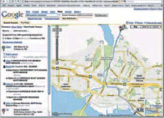
Although there are still a few bugs, we were able to use Google Transit to compare instructions for a fictitious trip from 200 Granville St. in Vancouver to Grouse Mountain. After an accident in the Grouse parking lot, we had to go to the Insurance Corp. of B.C. claims centre in North Vancouver at 255 Lloyd Ave. Traumatized by all this, we found it necessary to have dinner at a restaurant on Brunette Avenue in Coquitlam. – Total driving time and distance: about 47.3 kilometres that would include about 60 minutes of driving time. – Total transit time for same trip: Two hours and 36 minutes. But if you had taken transit you wouldn’t have had the accident, could have skipped the trip to ICBC and wouldn’t be traumatized. You would have spent just 48 minutes on the trip to Grouse, which has a very nice restaurant!
It seems like you can Google anything and, in Metro Vancouver, that now includes transit directions.
TransLink already has a transit trip planner on its website, www.translink.bc.ca.
Yesterday the metropolitan transportation authority and Google announced that Metro Vancouver has become the first region in Canada to be linked to the transit side of Google Maps.
A beta or introductory version of the site is available at www.google.ca/transit. A fully functional site is likely to be operating within a month.
“We want people to play with it and get used to it,” TransLink spokesman Ken Hardie said of the new Google feature.
Google Maps already provides driving instructions. The new transit site, in addition to telling you when and where to wait for what, allows you to compare the driving trip with the transit trips.
It includes street maps, satellite image maps and maps that combine streets with satellite images. Users can even zoom in a location to make sure they’re in the right spot.
Google’s Joe Hughes said a key to the system was designing it in an open format so information from other similarly formatted systems could be shared.
“We’re basically trying to create the best information sites we can,” said Hughes.
The site is a particular boon for tourists, who might not be aware of the TransLink trip planner, as well as the visually disabled because the TransLink site doesn’t work with programs that read out what’s on your computer screen.
Metro Vancouver is the 22nd Google Transit site in North America.
© The Vancouver Province 2007

