MDA project to help farmers, governments and traders better gather agricultural information
Brian Morton
Sun
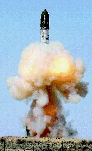
A Dnepr rocket (above) carrying a MDA-developed RapidEye satellite constellation launches from Kazakhstan’s Baikonur cosmodrome. Photograph by : Agence France-Presse; Getty Images
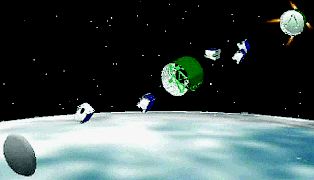
The satellite constellation (left) consists of five separate satellites. Photograph by : Agence France-Presse; Getty Images
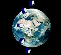
All five will be released into a shared orbit at 630 km from Earth and circle the globe 15 times daily, transmitting back high-resolution images. Photograph by : Agence France-Presse; Getty Images
RapidEye, a $170-million satellite project developed over five years by Richmond-based MacDonald, Dettwiler and Associates, is the newest constellation in space, and it’s expected to help farmers, municipal governments and commodity traders get a better handle on everything from crop conditions to weather patterns.
MDA launched RapidEye, an array of five satellites each weighing 150 kilograms, from Kazakhstan on Friday in a move that’s expected to position the company to take advantage of the emerging “smallsat” (high-performance/low-cost satellites) market.
“We’re using this to demonstrate to the world how advanced our smallsat capabilities are,” Wade Larson, MDA’s director of business development for the satellite division, said in an interview Monday. “We believe this will place us at the forefront of this emerging business model.”
Friday’s launch from a converted Russian-built Dnepr — a space-launch vehicle previously used to launch intercontinental ballistic missiles — will enable the German firm RapidEye AG to supply agricultural information to clients around the world. The technology will be used not only for things like monitoring crop conditions, weather and natural disasters, but also for disaster management and cartography.
“It takes images of the land like Google Earth, [but] it’s much broader,” Larson said of the project. “It covers four million square kilometres a day and can revisit any spot on the earth each day. It can be used for crop yield predictions and damage assessment.”
Larson said RapidEye picks up “signatures of organic material and compares what you’re getting from week to week.”
He also said RapidEye will be helpful for providing information in poorly mapped areas.
“In western China, they’re dealing with maps that are decades old. In Afghanistan, they’re often relying on maps the British produced over a hundred years ago.”
Larson said the cameras take 78-kilometre-wide swaths of high-resolution images.
He likened the technology to a “caravan of satellites” that are evenly spaced out around the earth along the same orbital plane. They’re 19 minutes apart and each satellite takes images of a different piece of land, he added.
MDA hired three main subcontractors to implement the satellite constellation portion of the project.
“Our information solution demonstrates that lower cost small satellite technology can now be deployed operationally to support business plans that would otherwise not be economically viable,” MDA president and CEO Daniel Friedmann said in a statement.
Larson said there are other remote sensing satellites in use, but that MDA’s is unique in that it uses five cameras that can revisit any location on the earth each day.
As well, he added, other satellite systems tend to produce either high-resolution images in a narrow swath, or low resolution images in a very wide swath. RapidEye, he said, produces high resolution in a wide swath.
© The Vancouver Sun 2008
