Vancouver House, 1480 Howe Street, BC


1480 Howe Street, Vancouver, BC, V6Z 1R8
Levels:
59
Suites:
388
Status:
Estimated Completion 2018
Built:
N/A
Map:
1 - Concord Pacific, Downtown & Yaletown Area
Concierge:
(604) 695-5300
On Site Manager:
N/A
Type:
Under Construction
Bldg #:
194
Vancouver House News Articles

PRINT VIEW


Need more information on this building click here

Main Image for Vancouver House, 1480 Howe Street

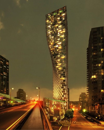
BUILDING WEBSITE Vancouver House at 1480 Howe Street, Vancouver, 388 suites, 59 levels. Contributing to the Vancouver skyline, Vancouver House is a  mixed-use tower by Westbank, DIALOG and BIG - Bjarke Ingels Group architects marks the entry point to downtown, forming a welcoming gateway to the city, while adding another unique structure. This website contains: current building MLS listings & MLS sale info, building floor plans & strata plans, pictures of lobby & common area, developer, strata & concierge contact info, interactive 3D & Google location Maps link www.6717000.com/maps with downtown intersection virtual tours, downtown listing assignment lists of buildings under construction & aerial/satellite pictures of this building. For more info, click the side bar of this page or use the search feature in the top right hand corner of any page. Building map location; Building #194-Map1, Concord Pacific, Downtown & Yaletown Area.

Strata Company:
N/A
Concierge:
(604) 695-5300
On Site Manager:
N/A
Developer:
Westbank Projects Corp. 604-685-8986
Architect:
Bjarke Ingels Group Architects (BIG CPH) +45.7221.7227


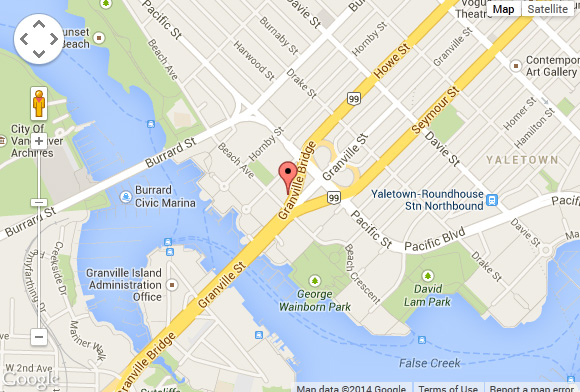
Google Map


Please click the image above to view full map. This will open in a new window.

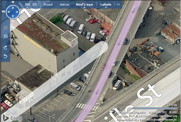
Bing Map


Please click the image above to view full map. This will open in a new window.


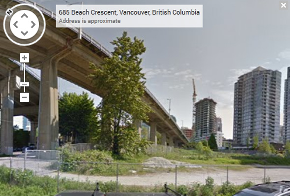
Google Street View


Please click the image above to view full map. This will open in a new window.

The tower is situated on a nine-story podium base offering market-rental housing with a mix of commercial and retail space. At its base, the footprint of the tower is conditioned by concerns for two significant neighboring elements, including a 30-meter setback from the Granville bridge which ensures that no residents will have windows and balconies in the middle of heavy traffic as well as concerns for sunlight to an adjacent park which limits how far south the building can be constructed. As a result the footprint is restricted to a small triangle.

As the tower ascends, it clears the noise, exhaust, and visual invasion of the Granville Bridge. BIG’s design reclaims the lost area as the tower clears the zone of influence of the bridge, gradually cantilevering over the site. This movement turns the inefficient triangle into an optimal rectangular floor plate, increasing the desirable spaces for living at its top, while freeing up a generous public space at its base. The resultant silhouette has a unique appearance that changes from every angle and resembles a curtain being drawn aside, welcoming people as they enter the city from the bridge.

The tower’s podium is a mixed-use urban village with three triangular blocks that are composed of intimately-scaled spaces for working, shopping, and leisure which face onto public plazas and pathways. The additional public space adds to the existing streets, giving the neighborhood a variety of open and covered outdoor spaces of various scales which transform the site under the Granville Bridge into a dynamic and iconic mixed-use neighborhood hub.

View Info From City of Vancouver


Artist's Concept of Beach And Howe
 

Artist's Concept of Beach And Howe
 

Under Granville Bridge
 

Artist's Concept of Beach And Howe
 

Artist's Concept of Beach And Howe
 

Artist's Concept of Beach And Howe
 

Site Plan
 

Podium
 

City Analysis
 

Elevations
 

Site

        1) Click Here For Printable Version Of Above Map

        2) Click here for Colliers full downtown area map in PDF format (845 KB)

Top

Click Here To Print Pictures - Six Per Page


Artist's Concept of
Beach And Howe
 

Artist's Concept of
Beach And Howe
 

Artist's Concept of Beach And Howe
 

Artist's Concept Under Granville Bridge
 

Artist's Concept of
Beach And Howe
 

Artist's Concept of
Beach And Howe
 

Rezoning Application
 

Rezoning Application
 

Site Location
 

View of Development
Site From Above
 

View of Development
Site From Above
 

View of Development
Site From Above
 

View of Development
Site From Above
 

Closed Gas Station
on Beach
 

Closed Gas Station
on Beach
 

Park Across Howe Street
 

Looking Northwest
along Howe
From Beach
 

Looking Southeast
Along Beach
From Howe
 

Corner of
Beach and Howe
 

Corner of
Beach and Howe
 

Closed Gas Station
 

Mini Storage
 

Mini Storage
 

Looking Southwest
on Howe
 
Top